


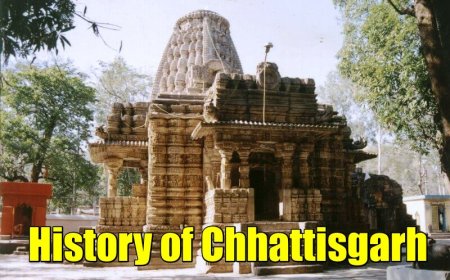
Geography of Chhattisgarh (Government-sourced, latest)
Geography of Chhattisgarh (Government-sourced, latest)
Geography of Chhattisgarh (Government-sourced, latest)
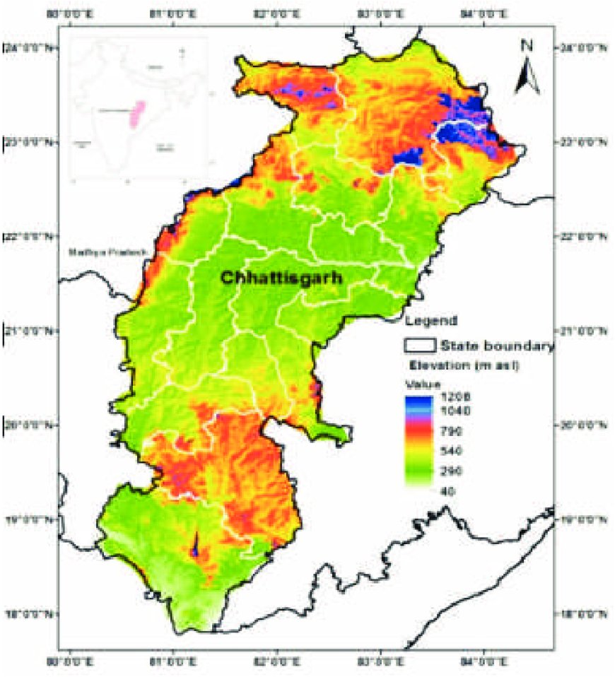
Location & extent
Chhattisgarh lies in central India between about 17°46′–24°5′ N and 80°15′–84°20′ E. The state covers 135,192 km² across 33 districts (five divisions). These facts are carried on the official Chhattisgarh state portal and allied district portals. cgstate.gov.inchhattisgarh.s3waas.gov.inigod.gov.in
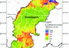
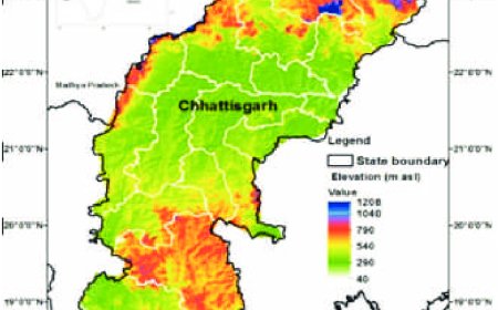
Physiographic regions
Government climate and environment documents divide the state into three broad regions:
-
the Northern Hills (Koriya–Surguja belt),
-
the Chhattisgarh Plain (Mahanadi basin core), and
-
the Bastar Plateau (southern highlands). MoEFCCcgclimatechange.com
Drainage & river basins
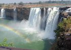
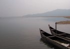
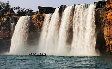
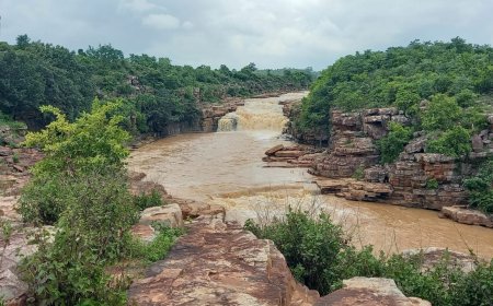
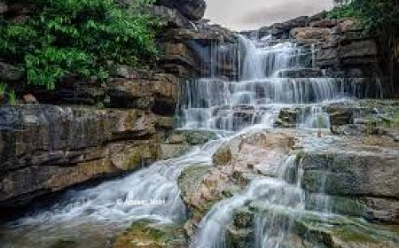
Hydrologically, Chhattisgarh straddles multiple major basins, chiefly the Mahanadi (largest share of the state’s area), as well as parts of the Godavari (notably the Indravati and Sabari sub-basins), Ganga, Narmada and Brahmani systems. Official basin notes and the State Water Resources Department list the state’s principal rivers as the Mahanadi, Sheonath/Shivnath, Hasdeo, Kharun, Arpa, Indravati, Pairi, Sondur, Jonk, and Sabari. India WRIS+2India WRIS+2The New Indian Express
Climate
Chhattisgarh has a tropical monsoon climate with a dominant June–September rainy season. The India Meteorological Department’s Raipur office reports a mean annual rainfall around 1,190 mm at Raipur (representative of the central plain), with hot summers and a cool, dry winter. AgroPhysics
Soils & agro-climatic zones
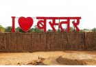
The state’s soils are mainly red & yellow, medium/deep black (Vertisols in parts of the plains), lateritic and alluvial pockets along river valleys—mapped by ICAR-NBSS&LUP. Administratively for agriculture and climate planning, the state recognizes three agro-climatic zones: Chhattisgarh Plain, Northern Hills Zone, and Bastar Plateau. Wikipediacgclimatechange.com
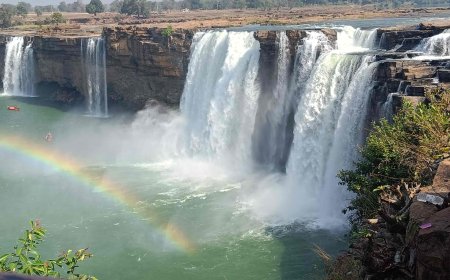
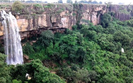
Forests & biodiversity (latest status)
According to the India State of Forest Report (ISFR) 2023 by the Forest Survey of India, Chhattisgarh has about 55,800 km² of forest cover, among the highest shares in India by percentage of geographical area. (FSI’s state factsheet and Volume-II tables carry the exact 2023 figures and district breakdowns.) Protected areas include Indravati National Park, Kanger Valley National Park, and Guru Ghasidas National Park; tiger reserves notified/managed under NTCA are Achanakmar, Udanti–Sitanadi, and the Guru Ghasidas–Tamor Pingla tiger reserve approved in 2021. ICAR-NBSSLUP
Land use & agriculture
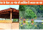
The Chhattisgarh Plain is the state’s rice bowl due to extensive alluvial tracts and irrigation from Mahanadi tributaries and reservoirs (e.g., Gangrel on the Mahanadi, Hasdeo Bango on the Hasdeo), while the Northern Hills and Bastar Plateau retain higher forest cover and undulating plateaus supporting forestry, minor millets, pulses and horticulture. State water and district portals detail the major rivers, dams and irrigation projects supporting these patterns. The New Indian ExpressRaipur Government
Geology & minerals (overview)
Chhattisgarh sits over parts of the Chhattisgarh Basin and Precambrian cratonic belts, hosting major resources of iron ore (Bailadila range, Dantewada), coal (Korba belt), bauxite, limestone and dolomite. Union government mining reports and the state Directorate of Geology & Mining provide current production/regulatory context; IBM and Ministry of Mines year-end/annual reports summarize the latest sector indicators. Chhattisgarh MinesMinistry of Mines+1
References (government & para-statal)
-
Government of Chhattisgarh – State/District portals (state area, districts, coordinates, administration). cgstate.gov.inchhattisgarh.s3waas.gov.inigod.gov.in
-
India Meteorological Department (IMD), Raipur – state climatology/rainfall brochure. AgroPhysics
-
Forest Survey of India (MoEFCC), ISFR 2023 – latest forest cover status and statistics for Chhattisgarh.
-
National Tiger Conservation Authority (NTCA)/MoEFCC – notifications/notes on tiger reserves including the 2021 approval of Guru Ghasidas–Tamor Pingla. ICAR-NBSSLUP
-
Chhattisgarh Water Resources Dept. (WRD) – state river basins and major rivers; India-WRIS/CWC – official basin profiles (Mahanadi, Godavari). The New Indian ExpressIndia WRIS+2India WRIS+2
-
ICAR-NBSS&LUP – soil resources mapping; Chhattisgarh State Climate/Environment documents – agro-climatic zonation. Wikipediacgclimatechange.com
-
Ministry of Mines / Indian Bureau of Mines (IBM) – annual and year-end reviews on mineral sector; Directorate of Geology & Mining, Chhattisgarh – state mineral profile. Ministry of Mines+1Chhattisgarh Mines
What's Your Reaction?
 Like
0
Like
0
 Dislike
0
Dislike
0
 Love
0
Love
0
 Funny
0
Funny
0
 Angry
0
Angry
0
 Sad
0
Sad
0
 Wow
0
Wow
0